Israeli startup Imagry takes contrarian mapless approach to autonomous driving
TEL AVIV, Israel — To map or not to map? That is the question facing autonomous driving technology developers.
Most use sensor data to compile detailed high-definition maps that chart roadway dimensions and features such as merging lanes, overpasses, signals and crosswalks. Others take a lighter approach, building maps that provide less detail.
While these maps inform the driving system about the fixed aspects of the road and potential hazards, some companies, most notably Tesla, go without them.
Imagry, an Israeli startup in Haifa (HY’-fuh), is moving ahead without high-definition maps, arguing its system better mimics human perception and is more efficient and less costly than other autonomous systems.
“It’s impractical to try to map the entire world in a resolution of a few centimeters,” Imagry CEO Eran Ofir told Automotive News.
Moreover, building and street construction, detours and other factors can make sections of maps inaccurate almost daily, he said.
Autonomous systems need the capability to operate independently, without the aid of external map data that could be outdated or subject to communications glitches that block access to cloud-based information, Ofir said.
It’s a contrarian viewpoint. More prominent autonomous technology players, including Waymo, Aurora Innovation and Mobileye, integrate at least some level of detailed mapping into their systems.
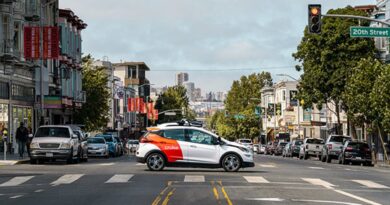
Imagry demonstrated its mapless self-driving technology last week during EcoMotion Week, a Tel Aviv conference and series of events focused on Israeli automotive technology. Its car drove through dense traffic in Haifa, avoiding double-parked vehicles, scooters and bicycles merging erratically from sidewalks, and other road hazards. The system is not entirely mapless, as it uses a basic navigation map system, such as Waze, to know its destination.
While it is possible to drive without highly detailed maps — that’s how humans do it — it’s safer for automated driving systems to have the extra information, said Amnon Shashua, CEO of Mobileye.
Detailed maps streaming into the vehicle provide backup information that is useful in tricky situations, such as encountering sections of roadway with no or obscured lane markings. The high-definition maps kick in and tell the car where it should be in the lane, Shashua said.
That’s why Mobileye works with the automakers that use its sensors and chips to collect data from millions of vehicles already on the road, building low-cost but detailed maps of most of the roadways in North America, Europe and other regions. Mobileye is using that information to support its development of hands-off, eyes-off automated driving systems and eventually fully autonomous systems for the robotaxi industry.
Waymo takes a more expensive approach, driving lidar-equipped vehicles through cities and elsewhere to derive even more detail about roadways.
“We’ve built an incredibly detailed set of mapping technologies that help our cars navigate places even where GPS struggles, like tunnels or between skyscrapers,” the company says on its website.
It merges that information with the sensors and perception tools onboard its robotaxis. The company said the high-definition maps provide data on what lies ahead, allowing the vehicle to drive smoother and more predictably.
Motional, the autonomous technology joint venture between Hyundai Motor Group and Aptiv that is working with Lyft to launch ride-hailing services in Las Vegas and Los Angeles, said high-definition mapping is one of the first steps it takes before operating in a city.
Balajee Kannan, vice president of autonomy at Motional, called it “critical to the safe operation of autonomous vehicles.”
But it does require “time and resources,” he said.
Longer term, Motional sees the vehicle operating “in a plug-and-play system,” in which raw sensor data from initial test drives can produce an accurate, highly detailed map quickly.
“There is no industry standard. There are multiple paradigms being worked on by multiple companies,” said Raj Rajkumar, an engineering and robotics professor at Carnegie Mellon University. “The best ideas will come out on top.”
At lower levels of automation — such as hands-free, foot-free driving systems — there’s little need for maps beyond the primary navigation system, he said.
The vehicle uses sensor and camera data to ensure it follows the car ahead at a safe distance and stays within the lane markings.
At higher levels of autonomy — with lane changes, entering and leaving highways, and more complex driving situations — a mapless system “can do a fairly reasonable job when the lane markers on the road are good and the lighting conditions are good,” Rajkumar said.
But he said high-definition maps with precise information about the size, positioning and directions of all the lanes, the location of infrastructure and buildings, and other detailed information would prove necessary, especially in inclement weather.
A look at the levels
Automakers and technology companies have used the Levels of Driving Automation, as defined by SAE International, to describe the capabilities and limitations of automated driving systems. Here are those levels and examples of some systems.
» Level 0 A human is driving at all times. Features are limited to warnings and momentary active assistance, such as automated emergency braking.
» Level 1 A human is driving at all times. Features support steering, braking or throttle inputs. Adaptive cruise control is an example.
» Level 2 A human is responsible for vehicle operations, even if they are not actively controlling the vehicle. Features provide both steering and throttle control, such as lane-centering and adaptive cruise control at the same time. General Motors’ Super Cruise system and Tesla’s Autopilot are in this category.
» Level 3 An automated system is responsible for driving when engaged in a specific area, such as a highway, but a human driver must take over when the system requests they do so.
» Level 4 An automated system drives, and a human has no role in the driving process. These systems may operate in specific conditions and limited areas. No vehicles with these types of systems are for sale to consumers.
» Level 5 The same as Level 4, except these vehicles can drive everywhere in all conditions.
Nonetheless, Imagry is moving forward with its system on two fronts. It plans to sell it to automakers looking for Level 3 and Level 4 autonomous driving for consumer vehicles and to operators of autonomous buses and shuttles. A Level 3 vehicle can handle all aspects of driving, but a human must supervise and be ready to take control. A Level 4 vehicle has sole custody of driving but can only operate under certain conditions.
The software-based system is designed to be used chiefly with cameras but also can integrate with additional sensors such as radar and lidar.
“Basically, the software is doing two things: perception and motion planning,” Ofir said.
The Imagry system takes video from eight cameras and feeds it into an array of neural networks — computers that learn to perform tasks by analyzing training examples. It is modeled on the human brain.
Each neural network is looking at something different.
“One is looking at traffic lights, one at traffic signs, one at pedestrians, one at lanes, one at moving vehicles, one at parked vehicles, and so on,” Ofir said.
The information creates a 3D rendering of the vehicle’s surroundings, which is used by software within the system to govern the vehicle’s motion planning. The system frees the car from operating only in a predetermined and mapped geography, as opposed to Waymo’s robotaxis in Phoenix and General Motors’ Super Cruise driver-assistance feature, which works only on a network of mapped highways, Ofir said. And it is robust enough to work in darkness and other difficult situations, he said.
Ofir said the system is platform and chipset agnostic and can work with any manufacturer. Going without high-definition maps dramatically reduces costs to the level at which automakers can afford to offer it in consumer vehicles, he said.
The company is seeking partnerships with automakers and suppliers. During EcoMotion, it announced a deal to integrate part of its technology into Continental’s automated driving platform. The software will power Continental’s automated parking, allowing a vehicle to cruise a parking lot, detect a space and park without the driver touching the steering wheel.
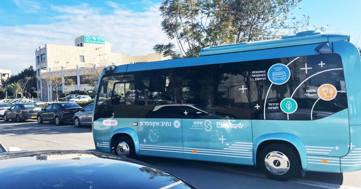
Elsewhere, Imagry has launched a pilot program with an autonomous bus at the sprawling Sheba Tel HaShomer City of Health medical center in Ramat Gan, Israel. It uses a safety driver for now while Imagry works toward getting both cybersecurity and minimum miles compiled certifications to remove the driver. Imagry also has approval from the Israel Innovation Authority to operate an autonomous bus on a 5-mile public transit route in Nahariya this year.
Ofir said Imagry’s system would continue to improve from machine learning and constant advancements in computing power.
“Within two, three years’ time, we will see vehicles driving with the supercomputers able to do 1,000 tera operations or more per second,” he said. “I’m utterly convinced that with that amount of computing, the autonomous machine will drive much better than us.”
Source : Autonews.com